Cartography Services to Support Your Environmental Analysis


In addition to graphic design, Visuals Design provides cartography/GIS mapping services. We specialize in perfecting maps created with ArcGIS or QGIS; adding a polished look by finishing map products in Adobe Creative Suite. This way, maps are not only accurate, but they are clear and easy to understand for both environmental consulting professionals and the general public.
By simply supplying us with your project site’s city or county parcel number, ESRI shapefiles, Google Earth KML file, and/or your GPS-mapped field data, we will work with you to create any of the thematic maps listed below, and more! Where needed, our products will be georeferenced to assure proper placement of site plans, resources, and impacts. We can spatially reference AutoCAD (DXF) files or site plans (PDF/JPG), depending on the initial resource material that you provide. For development projects, impacts will be calculated and provided to you in an associated MS Excel table.

Creating maps
that tell a story.
-
![Visuals Design Regional Location Map]()
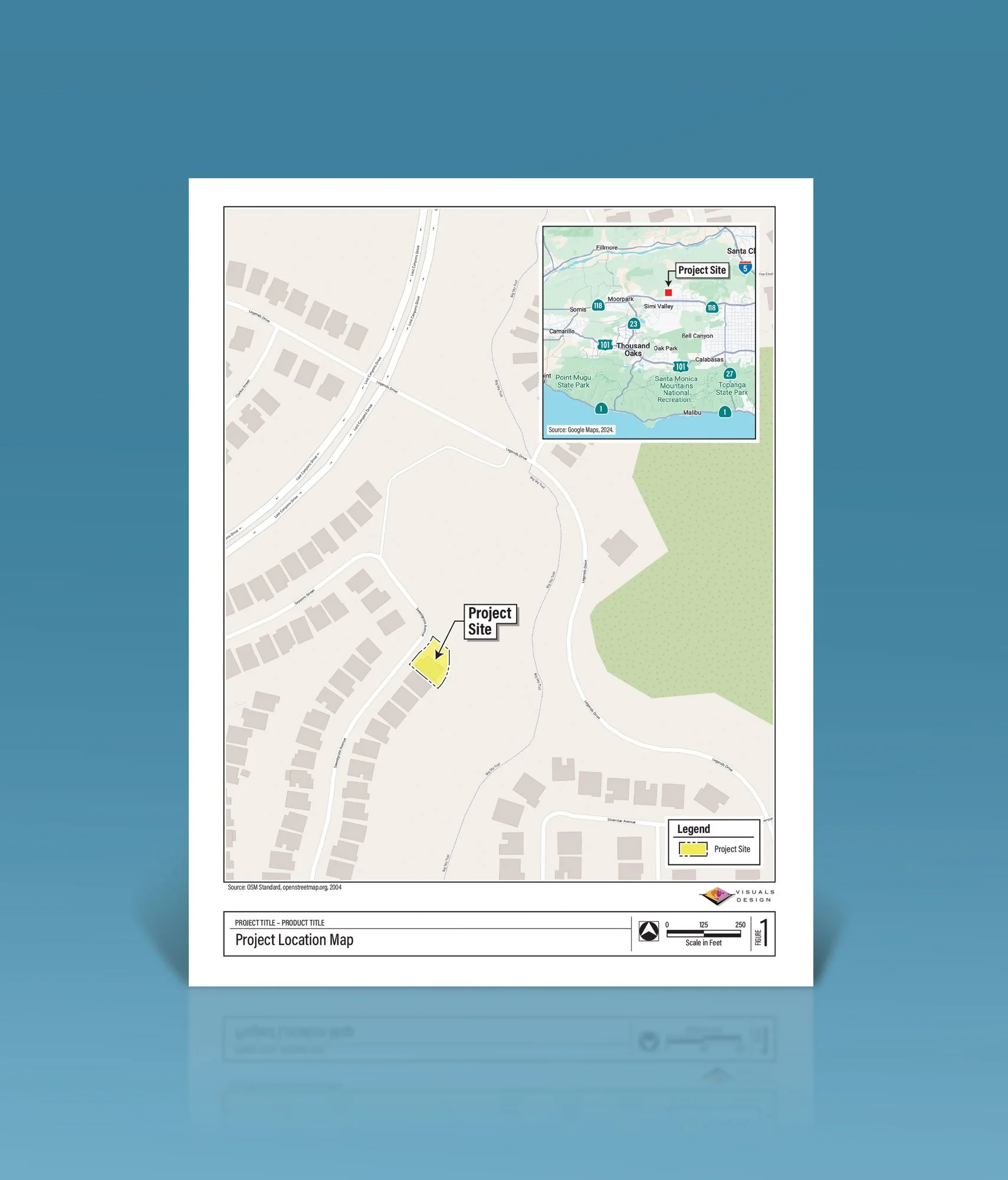
Regional Location Maps
Highlight the extent of your project site with a Regional Location Map. Include an inset map of the broader view of your surroundings.
-
![Visuals Design Local Vicinity Map]()
Local Vicinity Maps
For more detailed views, use a Local Vicinity Map, based on a Google Earth or Valtus aerial photograph, to show users specific features of your site.
-
![Visuals Design Soils Maps]()
Soils Maps
We can create Soils Maps created using the Natural Resources Conservation Services data for your environmental analysis.
-
![Visuals Design Vegetation Map]()
Vegetation Maps
With your survey data, we use ArcGIS or QGIS, and Adobe software to define vegetation/habitat categories in the project area.
-
![Visuals Design Jurisdictional Delineation map]()
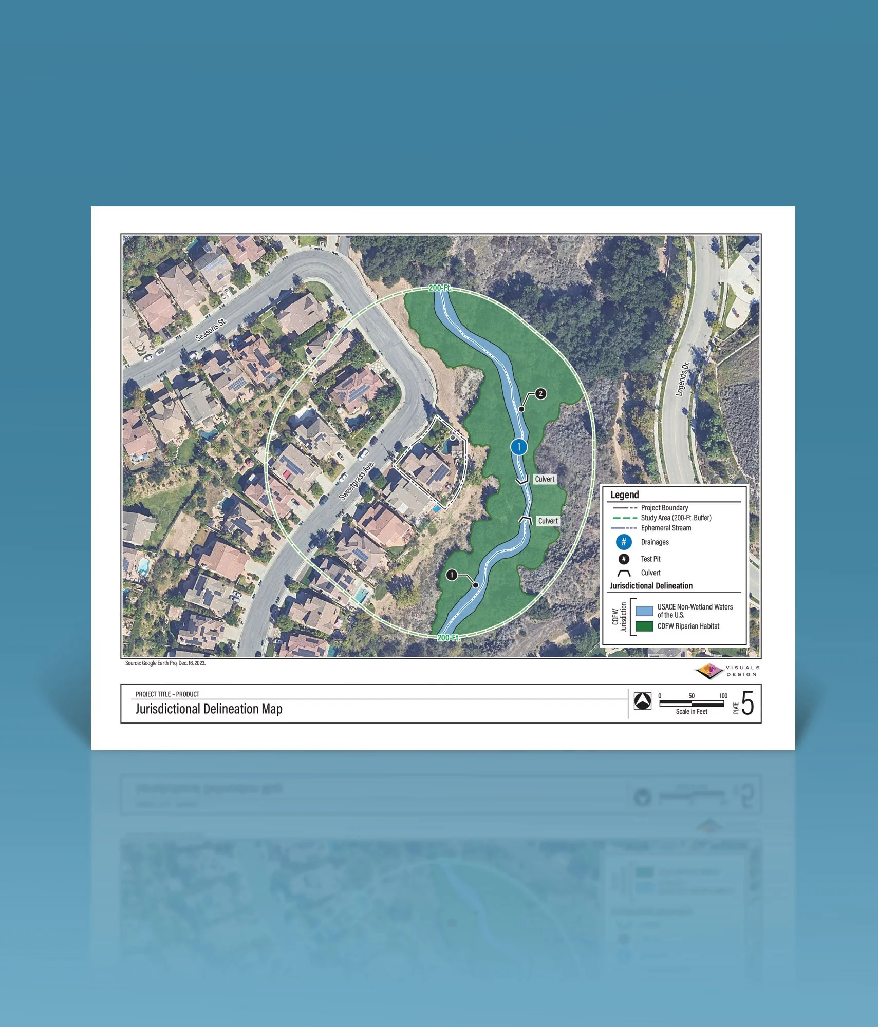
Jurisdictional Delineation Maps
With your survey data, we use ArcGIS or QGIS, and Adobe software to create Jurisdictional Delineation Maps that show the extent of riparian land under ACOE and CDFW Jurisdiction, that is affected in the project study area.
-
![Visuals Design - Elevation Contour Maps]()
Elevation Contour Maps
Elevation Contour Maps based on Lidar DEM data.
-
![Visuals Design - Phase 1 Cultural Maps]()
Cultural Resource Record Search Maps
To support Phase I Cultural Resource Assessments, and used as the base for showing ¼ or ½ mile radii around a project site. These maps are shown on a 7.5 min. USGS Topographic Quadrangle map base.
-
![Visuals Design - Photo Plates]()
Photograph Plates
Photograph Plates are used to illustrate views or features of the project site. Photograph location keys can also be provided.


Location Data
Project location data, including Lat/Long coordinates, Township & Range, and USGS Quadrangle base information, as well as APNs, can be provided.

Impact Calculations
Project Development Footprints, Limits of Disturbance, and Fuel Modification Zone impacts (if applicable) will be calculated and clean Excel tables will be provided.

Background Imagery
ESRI Backgrounds and Google Earth aerial imagery can be provided for your use. Specialty Valtus Rectified Aerial Imagery or Drone Photography is also available upon request.